Hey all,
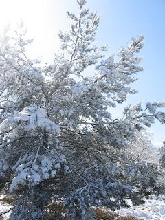
Wow. Time really does seem to be zooming along at the moment, I find it hard to believe that it’s already been over a week since my last post but the calendar is determined to prove otherwise. The weather on the other hand appears to have lost its calendar altogether and after careful consideration has decided that it's now winter. I was somewhat surprised therefore when I drew back my curtains on Sunday to find that someone had stolen my fine spring morning and replaced it with a winter wonderland. Still, on the plus side the sun was out and it wasn't raining for a change so I figured I might as well grab my rucksack, pull on the boots and go for a trundle around Cannock Chase.
 I'm quite fond of Cannock Chase. Not only because it's a lovely place for a stroll that's right on my doorstep but also because I've been walking up at the Chase with my family since I was a kid. I remember my dad used to drag my brother and me for a ramble every Christmas Eve in a valiant but vain attempt to wear us out so that he and my mum could enjoy a bit of a lie-in come Christmas Day. Another family favourite is a short stroll from the Punch Bowl (car park in a little valley) to the stepping stones (speaks for itself really) which is only a couple of miles at most but has nonetheless been the Sunday afternoon walk of choice in our family for years. That being the case there was really only one place for me to tromp about amongst the snow and so I shrugged into my pack (it's slowly getting heavier as I acquire more gear though for the time being it's still quite acceptable) and set out along the usual trail.
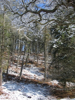
It was one of those walks where I didn't really have a plan, though a quick glance at the map provided me with a vague circuit of seven or eight miles which I figured would be ideal. I was quite content just to wander along at my own pace and enjoy the snow covered landscape before me. I found myself contemplating what exactly it was about snow that makes everyone into a budding photographer. There's no denying that a snowy scene can be exceedingly photogenic but after dodging around my forth camera tripod (conveniently set up in the middle of the path for maximum annoyance) I did begin to wonder whether I'd accidentally wandered into an outdoor photography convention. Such was my musing on the snow's appearance that I totally failed to spot the fact that it is also rather adept at concealing the various tracks and trails criss-crossing my route. This fact was hammered home rather effectively however when it suddenly occurred to me that I hadn't seen another person in about 20 minutes (the Chase is something of a magnet to outdoorsy types on a nice day) and whilst I wasn't lost I also had no idea where I was going. A hasty consultation of the map later, I had a plan to rejoin the trail.

I'd take the next path to the right and join up with the main road that I knew was running vaguely parallel to my route somewhere just out of sight (I could hear the occasional traffic quite clearly so I knew it was probably only a mile at most). I could then follow the road to the next junction where I could pick up another trail to take me along a winding stream and back into familiar territory. It started promisingly enough, the next path I took was wide, clear and most importantly heading in the right direction. Sadly said path also thought it would be amusing to lead me the brink of the road without a hitch and then dump me unceremoniously in an overgrown copse of trees. I wasted the next 20 minutes trying to find a way around the obstruction before finally losing patience and battering my way directly through the stubborn undergrowth whilst the snow from the branches above battered its way directly down the back of my shirt. It must be said that despite this little hiccup the rest of the walk went like clockwork. I found the next path a little further down the main road as I had expected and after a brief moment where I thought I had gone astray once again the little stream appeared from under its snowy blanket and led me all the way back to the stepping stones. Not a particularly strenuous walk really, but every mile I get in my boots makes them that little bit more comfortable which is going to pay dividends when I hit the trail for real.
Speaking of hitting the trail, I've now finally pinned down a start date for this little adventure after spending forever trying to find the best way to dodge around the bank holiday. I shall be setting off from Land's End on the 21st May with the hope of arriving in John O' Groats some 91 days later on the 19th August (though this will no doubt alter once I get under way). This gives me little over 5 weeks before the big day which is not much time at all given how the past week has flown by. It has however allowed me to add a bit more structure to my itinerary to the extent that I think it's ready for its first public appearance. What follows is my plan as it stands at the moment although until I stagger into John O Groats in August it should really be considered a work in progress. Still, it should give you some idea of where I will be and when, so if you fancy joining me for a day or two you'll know vaguely where to look.
Until next time folks.
LEJOG Itinerary21/05 - Day 1: Land's End -> Penzance (9.5 mi)
22/05 - Day 2: Penzance -> Pengoon Farm (13.5 mi)
23/05 - Day 3: Pengoon Farm -> Carnon Downs (12.5 mi)
24/05 - Day 4: Carnon Downs -> Carnon Downs (0 mi)
25/05 - Day 5: Carnon Downs -> Trekenning (17 mi)
26/05 - Day 6: Trekenning -> St Breward (17.5 mi)
27/05 - Day 7: St Breward -> Five Lanes (12 mi)
28/05 - Day 8: Five Lanes -> Five Lanes (0 mi)
29/05 - Day 9: Five Lanes -> Roadford Lake (17 mi)
30/05 - Day 10: Roadford Lake -> Bridestowe (11.5 mi)
31/05 - Day 11: Bridestowe -> Venton (13 mi)
01/06 - Day 12: Venton -> Salmonhutch (12.5 mi)
02/06 - Day 13: Salmonhutch -> Salmonhutch (0 mi)
03/06 - Day 14: Salmonhutch -> Tiverton (13.5 mi)
04/06 - Day 15: Tiverton -> Taunton (20 mi)
05/06 - Day 16: Taunton -> Street (20 mi)
06/06 - Day 17: Street -> Radstock (18 mi)
07/06 - Day 18: Radstock -> Radstock (0 mi)
08/06 - Day 19: Radstock -> Bath (12 mi)
09/06 - Day 20: Bath -> Tomarton (13.5 mi)
10/06 - Day 21: Tomarton -> North Nibley (15 mi)
11/06 - Day 22: North Nibley -> Painswick (15.5 mi)
12/06 - Day 23: Painswick -> Cheltenham (11 mi)
13/06 - Day 24: Cheltenham -> Tewkesbury (10 mi)
14/06 - Day 25: Tewkesbury -> Tewkesbury (0 mi)
15/06 - Day 26: Tewkesbury -> Worcester (14 mi)
16/06 - Day 27: Worcester -> Stourport (14 mi)
17/06 - Day 28: Stourport -> Kinver (13 mi)
18/06 - Day 29: Kinver -> Brewood (18.5 mi)
19/06 - Day 30: Brewood -> Stafford (14.5 mi)
20/06 - Day 31: Stafford -> Stafford (0 mi)
21/06 - Day 32: Stafford -> Uttoxeter (15.5 mi)
22/06 - Day 33: Uttoxeter -> Fenny Bentley (14.5 mi)
23/06 - Day 34: Fenny Bentley -> Blackwell (16.5 mi)
24/06 - Day 35: Blackwell -> Edale (12 mi)
25/06 - Day 36: Edale -> Crowden (16 mi)
26/06 - Day 37: Crowden -> Crowden (0 mi)
27/06 - Day 38: Crowden -> Standedge (11 mi)
28/06 - Day 39: Standedge -> Hebden Bridge (17 mi)
29/06 - Day 40: Hebden Bridge -> Cowling (10 mi)
30/06 - Day 41: Cowling -> Malham (16 mi)
01/07 - Day 42: Malham -> Malham (0 mi)
02/07 - Day 43: Malham -> Horton (13 mi)
03/07 - Day 44: Horton -> Hawes (12.5 mi)
04/07 - Day 45: Hawes -> Keld (12.5 mi)
05/07 - Day 46: Keld -> Middleton (18.5 mi)
06/07 - Day 47: Middleton -> Langdon Beck (7.5 mi)
07/07 - Day 48: Langdon Beck -> Langdon Beck (0 mi)
08/07 - Day 49: Langdon Beck -> Dufton (12 mi)
09/07 - Day 50: Dufton -> Alston (19 mi)
10/07 - Day 51: Alston -> Greenhead (15 mi)
11/07 - Day 52: Greenhead -> Stonehaugh (14 mi)
12/07 - Day 53: Stonehaugh -> Bellingham (8 mi)
13/07 - Day 54: Bellingham -> Bellingham (0 mi)
14/07 - Day 55: Bellingham -> Cottonshopeburnfoot (13 mi)
15/07 - Day 56: Cottonshopeburnfoot -> Jedburgh (18.5 mi)
16/07 - Day 57: Jedburgh -> Melrose (16 mi)
17/07 - Day 58: Melrose -> Melrose (0 mi)
18/07 - Day 59: Melrose -> Innerleithen (18.5 mi)
19/07 - Day 60: Innerleithen -> Peebles (9 mi)
20/07 - Day 61: Peebles -> West Linton (15 mi)
21/07 - Day 62: West Linton -> Edinburgh (18.5 mi)
22/07 - Day 63: Edinburgh -> Edinburgh (0 mi)
23/07 - Day 64: Edinburgh -> Beecraigs (21.5 mi)
24/07 - Day 65: Beecraigs -> Beecraigs (0 mi)
25/07 - Day 66: Beecraigs -> Kilsyth (20 mi)
26/07 - Day 67: Kilsyth -> Drymen (20.5 mi)
27/07 - Day 68: Drymen -> Drymen (0 mi)
28/07 - Day 69: Drymen -> Rowardennan (14 mi)
29/07 - Day 70: Rowardennan -> Inverarnan (12.5 mi)
30/07 - Day 71: Inverarnan -> Tyndrum (10.5 mi)
31/07 - Day 72: Tyndrum -> Kingshouse (17 mi)
01/08 - Day 73: Kingshouse -> Kinlochleven (9 mi)
02/08 - Day 74: Kinlochleven -> Kinlochleven (0 mi)
03/08 - Day 75: Kinlochleven -> Fort William (15.5 mi)
04/08 - Day 76: Fort William -> South Laggan (19 mi)
05/08 - Day 77: South Laggan -> Invermoriston (14 mi)
06/08 - Day 78: Invermoriston -> Invermoriston ( 0 mi)
07/08 - Day 79: Invermoriston -> Drumnadrochit (14 mi)
08/08 - Day 80: Drumnadrochit -> Inverness (19 mi)
09/08 - Day 81: Inverness -> Inverness (0 mi)
10/08 - Day 82: Inverness -> Dingwall (15.5 mi)
11/08 - Day 83: Dingwall -> Alness (9 mi)
12/08 - Day 84: Alness -> Dornoch (20 mi)
13/08 - Day 85: Dornoch -> Dornoch (0 mi)
14/08 - Day 86: Dornoch -> Brora (19 mi)
15/08 - Day 87: Brora -> Helmsdale (10 mi)
16/08 - Day 88: Helmsdale -> Dunbeath (15 mi)
17/08 - Day 89: Dunbeath -> Dunbeath (0 mi)
18/08 - Day 90: Dunbeath -> Wick (21 mi)
19/08 - Day 91: Wick -> John O' Groats (17.5 mi)


 Overnight I appear to have inhaled a wandering band of butterflies who are seemingly making the most of their new found lodgings by having a party in my stomach. Yes, today is the day and whilst I've been fruitlessly trying to nudge along the passage of time to get here over the last few months now that it's finally arrived I'm wising I had more time to prepare. Still it wouldn't be an adventure if it was easy now would it and given my working status up until last Friday I think I've done all I can in the time I've had.
  Of course, that doesn't mean that I'm not going to spend the rest of the morning re-checking (and probably re-re-checking) the contents of my backpack for all those things that I've undoubtedly forgotten and as such this final pre-walk blog entry is going to be a little on the brief side I'm afraid. That said, once I hit the trail tomorrow morning I'll be trying to write a diary entry every day, which should hopefully be inserted into the blog on a vaguely weekly basis depending on the speed of the local postal service (yes I really am that low-tech).
  Before I scurry off to continue my final preparations, I just want to say a few words of thanks. First on the list is my family, without whose endless support and encouragement this journey would certainly have never become a reality. Thanks also to my awesome friends who have shown outstanding patience with my endless LEJOG conversations and when the going gets tough their support will keep me on the trail. Thanks to everyone who has generously donated a portion of their hard-earned money towards my fundraising endeavours for the hospice, I promise you that it will make a huge difference to the lives of patients and their families. On the fundraising front, special thanks go out to Walton High School, Barnfields Primary and Berkswitch Primary who have all been kind enough to raise money on my behalf. A special mention goes out also to my Canadian friends across the pond for their extremely generous contribution to my fundraising total. Finally thanks to any and all who have taken the time to read this little rambling diary of mine over the past months, I'm sure it will continue to be an excellent vent for my thoughts, joys and frustrations over the next 1200 miles.
  Right, that’s about it for now I'm afraid. I would have liked to write a little section about the excellent weekend (despite the weather) I've just spent camping with my friends in the Peaks but I fear the butterflies will not let me sit still any longer. In compensation to the fine individuals that gave up their weekend to sit in a field with me, I've inserted a few photos from the trip to make up for the lack of prose.
 All the best to everyone and I'll speak to you from the trail soon.
  First off, apologies for the lack of posting last week. I spent most of the weekend trying to sort out some bits and bobs for my plans after the LEJOG, which unfortunately left little time to do anything for the LEJOG itself. Rather than trying to stretch an entire post to convey the above three lines I thought I'd give myself a little break and wait a week before continuing my ramblings. Of course, that now means that I have to try to cram a week and half’s worth of anecdotes into one tiny blog post. Now, before you take a shifty glance at the clock and start to wonder if you have the time/energy to read this bumper post (yes I know that I write too much, count yourselves lucky that you only actually see the shorter edited version) bear in mind that it's now only two weeks till the big day. With the starting line in sight it must be said that there is not much left really that needs to be done and hence fewer admin tasks to bang on about in prose. With a couple of small exceptions, my plans are all in place, my hoard of equipment is complete (although I'm almost certain I will have forgotten some small but essential item) and despite still feeling slightly un-prepared practice wise, I'm just counting down the days until I can finally get under way.
  Speaking of practice, now that all the paperwork for this trip has been squared away I've finally had chance to get a bit of decent hiking in without having to feel guilty about using up my precious planning time. Having spent most of my training days thus far plodding around the woodland of Cannock Chase (nice though it is) I was feeling ready for a bit of a change of scenery not to mention a change in the weather. I'm pleased to say that this weekend I was fortunate enough to get both at the same time and also have a nice catch up session with my good friends Rob and Vicky at the same time. The plan was for Rob and I to spend the day tromping around the Nottinghamshire countryside after which we would meet up with Vicky back at their flat and go out to the pub for dinner. As plans go, this one was pretty hard to fault.
 Buoyed up by the sense of optimism we strode out along the road towards Berry Hill which would serve as our first target of the day. Unfortunately it seemed that everyone else in Nottingham decided to join us on the road to Berry Hill and rather than walking they had opted for the motorised transport option. So much for a stroll and a convivial conversation, Rob and I had to shout just to be heard over the traffic and there really is nothing pleasant about slogging along a litter strewn verge (insert littering rant here). After putting so much effort into getting to my namesake, Berry Hill turned out to be little more than a car park beside an old dried up canal lock. I'm not quite sure what I was expecting to be honest but perhaps some sort of hill wouldn't have been beyond the realms of imagination given the name. It's a bit like going to Loch Ness and finding out it's a cement factory. Still disappointment aside, we had a quick look at the overgrown waterway before striking out along the old towpath and onto our next destination St Mary's Church at Colston Basset.
 We caught our first glimpse of St Mary's long before we actually got to it through the rolling farmland. Standing proud upon the hillside above Colton Basset it's not immediately obvious that what you’re looking at is really little more than a shell. The church was gutted back in 1898 to make way for the new church of St John the Divine in the village itself. Maybe I've just got a soft spot for old buildings, but to let something that was built with such skill and care fall into ruin in order to build another half a mile away seems like a tragic waste. Fortunately, the site of St Mary's has been lovingly restored and it served as an excellent place for a spot of lunch whilst we poked around the ruins. It was upon entering the church itself that I suddenly became aware of deep humming noise. It appeared to be coming from the bell tower so I thought I'd put my sleuthing hat on and try to determine the source of the disturbance. This source became swiftly apparent when I tilted my eyes skyward inside the tower and beheld a veritable cloud of bees. Luckily, Rob was there to catch my hasty retreat on camera for all posterity. Cheers for the support matey!
  After my escape from the little flying honey factories we thought it might be best to press on and leave the new residents of St Mary's in peace. So we gathered up our belongings and set out through the bustling little village and into the farmland beyond. Farmland walking does have a tendency to get a little tedious after a while (well to me it does), but after spending the whole morning hiking along the road it was pleasant to just have a bit of peace and quite and some soft ground underfoot. Nevertheless by the time we reached our third stop off point of the day, Vimmy Ridge, I think we were both ready for a bit of a change. Things were not helped by the fact that my pack (which until then had been an unobtrusive passenger on this little endeavour) was starting to become more of a burden and the thought of dragging it through yet another field of oil seed rape was not especially enticing. However a look at the map revealed that in order to get back to our starting point, we had a choice of more fields or more roads and so by default the former won out. I've noticed that this paragraph is getting a little negative, but it should be noted that on even the best hike, the last few miles is inevitably spent fantasizing about kicking off the boots and relaxing with a well earned pint. That's not to say that after said pint and an hour or two's rest you're not eager to begin the whole process again, but that's not always an easy thing to keep in mind when the hiking pixies are sneaking lead weights into your pack with every step.
 I haven’t really got much to say about the last 3-4 miles from Vimmy Ridge to Rob and Vicky's flat except that it swiftly became an exercise in endurance. There were some pleasant distractions though, such as watching the little planes buzzing in and out of the local airfield as we trundled past and the sudden appearance of pine forest on the outskirts of the city made for a pleasant (if belated) change to the scenery. For the most part though I just kept my head down and plodded slowly towards my destination whilst at the same time feeling bad for holding up Rob who unencumbered by a portable home in a bag was clearly none the worse for wear from the days exertions. Still, "slow and steady wins the race" they say and we did of course eventually make it back to the flat, albeit with slightly less of a spring in our step than we left with.
 I must admit that that evening I began to feel a little apprehensive about the 1200 mile walk I'm starting in two weeks time. We set out that morning with the aim of doing a 16-17 mile route and if that was the case then it was considerably harder on the knees than I had anticipated it was going to be. I was a bit confused though, as I've done that sort of distance in the past without too much complaint (notice how I've used the qualifier 'too much') and surely the training I've been doing up to now should make it easier rather than harder. Deciding that this merited closer investigation I dug out my map measurer from the bottom of my bag and set about getting an accurate mileage for the day. I'm pleased to say that our guestimation skills leave a lot to be desired, as our steady 16-17 mile day turned out in fact to be a 21 mile slog. This caused a hasty u-turn in my appraisal of the situation, as at 21 miles the walk was just half a mile short of longest day I've got planned all summer and if I could manage it now then by the time I've had a couple of months on the trail to toughen up, I should have no problems going that little bit further.
 I'm actually feeling pretty optimistic about the whole endeavour at the moment, which is something of a change from a couple of weeks ago where I couldn't see beyond the endless stream of jobs laid out before me. Now that I have for the most part sorted those little conundrums I'm feeling much more organised although from a purely physical standpoint I would still really like to get out and get some more practice miles under my belt. Alas it does as ever come down to the quantity of free time available to me and as I have yet to perfect a method of being in two places at once I've just got to accept a few compromises with my preparation I suppose. It's just occurred to me that you're probably not reading this in order to hear a grown man complain (though if you are, might I take a moment to point out what an odd taste in reading material you have) so I'll concentrate instead on what I have actually accomplished rather than what I haven’t.
  As you well know by now, I'm doing this challenge in order to raise money for Katharine House Hospice (though I must confess that my own ambition to walk the weather map is also a factor) so to try to drum up some support from the fine people of Stafford I penned a letter to all the local papers with the hopes that they would stick a mug shot of yours truly and a few well chosen words in their next publication. At the time of writing only the Stafford Chronicle have had the excellent judgement to take me up on this tempting offer though I'm hoping to turn on the charm (if I can remember how that is) and talk my way into a few others before setting off. As far as I can remember Monday morning was the first press interview I've ever had and it was certainly my first photo shoot. I'm generally one of those people who is happier to be behind the camera rather than in front of it, so having to strike a variety of poses for the photographer whilst passing shoppers tried to figure out who I was supposed to be, was a slightly uncomfortable experience. I think it’s the smiling that I have a problem with. Look at a selection of pictures of my good self and on the vast majority I will be wearing the same sort of impassive expression. This has nothing to do with my mood at the time of the shot, but is more to do with the fact that any time I attempt to force a smile for the sake of photographic posterity I invariably come off looking either hopelessly vacant or worryingly sinister. It was with some trepidation then that I searched for my article in the latest issue of the paper wondering which side of the scale I was going to land on this time. It may sound a bit vain, but I was nonetheless pleasantly surprised then to find that the picture was actually not too bad (I suppose that’s the difference a professional photographer makes) however such relief was short-lived when I read the accompanying caption declaring the fund raising trek of a "Mr Chris Perry". Better luck next time I suppose.
  It's official, I now have reached the point where I have more equipment than I can fit into the pack that I'm attempting to carry it in. Up until last weekend even fully packed my bag was worryingly empty considering the length of the journey I've got ahead of me. That is definitely not the case any longer and I've been forced to look at my assembled possessions with a "what do I need" rather than a "what do I want" perspective. To be fair to myself (and I'm writing this so why would I be anything else) pretty much everything I've bought is safely in the essential pile and it’s really only my clothes that have been trickier to categorize. The tricky part is trying to decide how many days I can cope with looking/smelling like Tarzan before I reach somewhere with laundry facilities and make myself presentable again. This isn't helped by the fact that I have always sweated like a beast during any form of exercise and when you add a weighty 70 litre rucksack into the mix my chances of being arrested for vagrancy on my travels are looking high.
 Now that I've finally got all of my gear together, I thought it was well past time I throw it all into my bag and try carrying it across the countryside for a bit. I reckon the only way I'm going to be able to get an idea of how much weight I'm going to want strapped to my back for three months (if you're curious, none at all would be my ideal answer) is to go ahead and try it as many times as I can in advance. So with my folks in tow, we decided to spend Sunday walking another small section of my route for the summer, namely Shugborough to Penkridge. I've done this walk before and I can see myself doing it a few more times yet before the 21st. At a little over 10 miles it’s hardly a mammoth trek but it's long enough to get the blood pumping and strengthen up my legs a fraction more. As a training walk, probably the best selling point in my opinion is that it has a little bit of everything, woodland and hills on the chase, roads and fields around Bednall and canal towpaths into Penkridge. Given that this was the first walk with everything I intend to take with me on the LEJOG I wasn't really sure what to expect and more importantly whether my back and knees would protest about the extra strain. I was really pleased (and a little suprised) then when we reached Penkridge and I still felt pretty fresh. I know it was a short day in comparison to some of the 20-21 milers ahead but hopefully by the time I get to the longer days I will have had a chance to build up some strength on the trail. Besides I'm not attempting to break any records, and if I feel that I need an hour or two resting my legs in the pub half way through one of the longer stretches then I shan't hesitate to do so. After all, it would be rude not to sample the local beverages of the places I pass through now wouldn't it.